MLIT telemetry download system
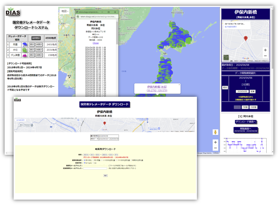
The Ministry of Land, Infrastructure, Transport and Tourism (MLIT)'s telemetry system is a system that acquires, records and distributes hydrological observation values in real time from remote locations. DIAS receives this telemetry data from the MLIT.
This system is for displaying and downloading this telemetry data for each observation point.
How to Use
You will need to apply for a DIAS account. You will also need permission to use the ‘MLIT Telemeter Data’.
Please access the permission application form from the ‘Download Data’ banner on the metadata page, and apply by entering the required information.