Introducing DIAS Movie (10’52”, Japanese w/ English caption)
Overview
While large changes in nature causes tremendous disasters to human society, the effects of human activities, such as global warming and destruction of ecosystems, bring about a change in the natural system and become a constraint on human activities.
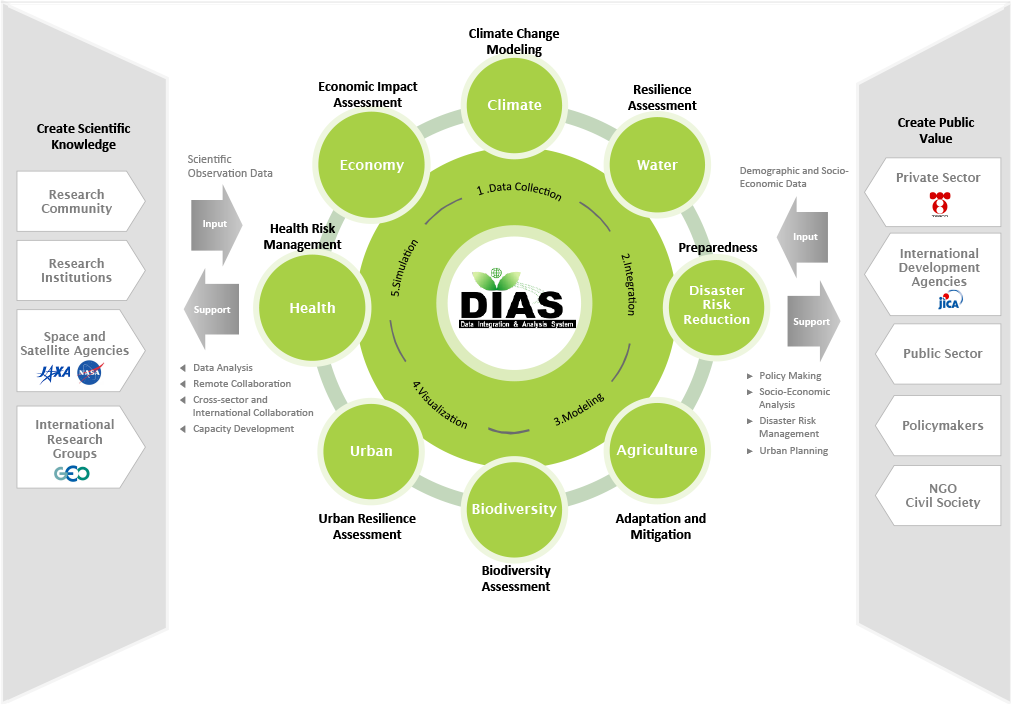
Data Integration and Analysis System (DIAS) started in 2006. The goals of DIAS are a contribution to realize Japan’s comprehensive security and safety of national citizens according to collect and store earth and each area’s observation data for a long time;
to analyze such data in combination with socio-economic data, and convert data into information useful for crisis management with respect to global-scale environmental disasters, and other threats; and to make this information available within Japan and overseas.
History
| 1980’s | “Global Environment Data Repository” was started by Prof. Mikio Takagi at the Institute of Industrial Science, The University of Tokyo. Its development was supported by numerous projects. |
| 2006-2010 | The phase I project of Data Integration and Analysis System was launched as "Earth Observation and Ocean Exploration System". It is regarded as one of National Key Technologies. A prototype was developed in 2010. |
| 2011-2015 | In the phase II project, the name of DIAS changed into “Data Integration & Analysis System Program (DIAS-P) ”. the further advancement and expansion of functionality were carried out to apply DIAS as a social and public infrastructure. |
| 2016-2020 | The phase III project has begun as “the Program to Promote the Development of Earth Environmental Information Platform”. This project focuses on developing and operating the long-term stable system as a social platform. This system aims to provide the service and operate the applications, which would help solve various social problems, including climate change adaptation and mitigation. |
| 2021- | Phase IV of the project started as the "Data Integration and Analysis System" Platform Project. The project aims to expand and develop further data utilization by using the information infrastructure established so far, and to collaborate with other information infrastructure, such as the Earth Simulator operated by JAMSTEC, to achieve long-term stable operation as a data integration and analysis platform (hub) that will contribute to solving economic and social issues arising from climate change. |
International contributions of DIAS
Internationally, DIAS has realized connecting to many data centers participating Global Earth Observation System of Systems (GEOSS) worldwide and is positioning itself as an international contributor to GEOSS. In addition, the work of the information infrastructure (e-Infrastructure) necessary for interdisciplinary and transdisciplinary collaboration that the Belmont Forum is undertaking, a meeting of science and technology funding agencies, recognizes DIAS as a leading example of the most comprehensive approach.
In addition, DIAS collaborated with many projects to continue to develop and progress in building long-term and stable systems as a social platform to contribute to global social issues such as climate change adaptation and mitigation.
Status of DIAS data archive
Various information is necessary to solve environmental issues, including global-scale observation data; reanalysis data; local observation data for down-scaling and the construction of advanced models; urban building, vegetation distribution, soil and other surface cover information; and sewage network information. Furthermore, climate change projection data such as CMIP is essential for climate change impact assessment. In addition, it is necessary for stakeholders to provide the data involved in problem resolution, such as statistics on the outbreak of disasters and health hazards, and crop yields, fishing hauls, and other production statistics.
DIAS archives such kinds of data according to the priority of the associated project. In areas such as Asia and Africa where support is needed for data archiving, DIAS provides an integrated support portal for metadata creation, quality management, and data input. Meanwhile, data easily available to specialists is not necessarily archived in DIAS.
Moving forward, the data created in each associated project for the purpose of building advanced models is scheduled to be sequentially archived in DIAS, and open data from various ministries is expected to increase through coordination with government agencies.
Promotion of Earth Observations in Japan
In the last five years of the GEOSS 10-year Implementation Plan (2005-2015), it has been necessary to accelerate the integration of the global observation systems in Japan. To this end, it was decided to centrally register and publish metadata files including public URLs for data and observation items on the Ministry of Education, Culture, Sports, Science and Technology (MEXT) Earth observation portal site with the aim of releasing and sharing observation data for the Action Plan for Japanese Earth Observations.
When an institution implementing an Earth observation project creates a metadata file, the properties of the data which each projects accumulate and store are scrutinized and in principle, the DIAS metadata creation support tool is used to create the metadata in order to promote the unification of metadata formats and the integrated application of data. Already metadata registration has done as a target of more than 100 projects and currently registration of more than half of them is completed. When metadata of data sets within the projects are already opened, the metadata is downloaded and processed sequentially to make it retrievable by the Search and Discovery System for DIAS Datasets.